geophile
4775
Karma2010-07-22
CreatedRecent Activity
Commented: "Your phone is an entire computer"

All good points. But what would be really useful and easy is allowing the iPhone to be used as a full-fledged computer on a file system completely distinct from that used to run the phone. Then my laptop is just peripherals connected to my phone.

I think it’s a pretty strong statement. It is unfortunately weakened by going along with the “Department of War” propaganda. I believe that the name is “Department of Defense” until Congress says otherwise, no matter what the Felon in Chief says.
Commented: "Making geo joins faster with H3 indexes"
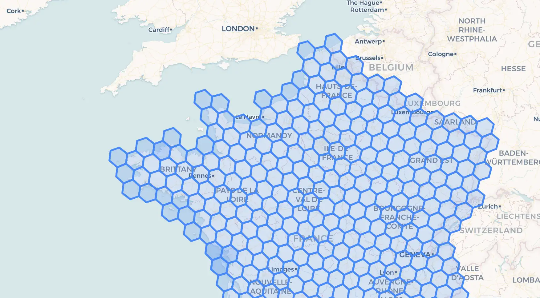
Z-order based indexes avoid the resolution problem. Basically:
- Generate z-values for spatial objects. Points -> a single z-value at the highest resolution of the space. Non-points -> multiple z-values. Each z-value is represented by a single integer, (I use 64 bit z-values, which provide for space resolution of 56 bits.) Each integer represents a 1-d range. E.g. 0x123 would represent 0x123000 through 0x123fff
- Spatial join is basically a merge of these z-values. If you are joining one spatial object with a collection of N spatial objects, the time is logN. If you are joining two collections, then it's more of a linear-time merge.
For more information: PROBE Spatial Data Modeling and Query Processing in an Image Database Application. IEEE Trans. Software Eng. 14(5): 611-629 (1988)
An open source java implementation: https://github.com/geophile/geophile. (The documentation includes a number of corrections to the published algorithm.)

The article gets at this briefly and moves on: "I can do all of this with the experience on my back of having laid the bricks, spread the mortar, cut and sewn for twenty years. If I don’t like something, I can go in, understand it and fix it as I please, instructing once and for all my setup to do what I want next time."
I think this dynamic applies to any use of AI, or indeed, any form of outsourcing. You can outsource a task effectively if you understand the complete task and its implementation very deeply. But if you don't, then you don't know if what you are getting back is correct, maintainable, scalable.
